


Start for a virtual Romania
Published on
In a few years now, one can see every corner of Romania by browsing an online map. Considering the EU directive, Inspire, which aims at creating a 3D map for the EU, the National Agency for Cadastre from Romania, ran in the past two years a photo shooting in which our country “showed off” its landscapes to a special photo camera, set on a plane.
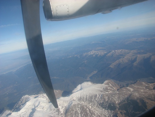 Carpatian Mountains
The shootings started in 2005 but because of the bad weather, only 70% of the country was captured, the rest of it being shot in 2006, during the months without vegetation (beginning of March-mid April and October-November).
The technique used is very complex. The specialists first used an air-photo camera, having the dimensions of a washing machine, where the photographer was in fact represented by three people (the operator for the air-photo camera, an assistant and the operator for the annexes of the photo camera). But since the process was complicated they started instant photo shooting, using a digital camera. Smaller and with a large memory (over one terra-byte) this camera covered all the requirements, the most important being the efficiency and a high resolution (one pixel can reach 5 cm). After all top secret information have been taken out from the pictures (military bases or any other info which might affect the national security), these are processed through a software that reconstructs the puzzle, giving the final picture of the country.
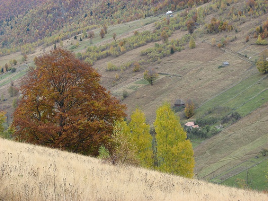 Transylvania sight
Soon one can virtually travel on the streets of Romania, changing the altitude of its sight, even getting to know the height of the trees or being capable of seeing inside one’s flat (the picture would be of emptiness cause nobody would gather information about the interior).
The first cities that will soon benefit of this kind of maps will be Craiova and Galati. The fact is that these maps are very expensive, only for Craiova costs around 3 million euro, but the advantage is that apart from the streets, it will show every detail of the buildings: area, the year it was built in, the materials is made off, the type of walls, if there is any pillar in the yard or any hydrant.
Moreover it will show the type of the electricity cables and the water pipes from the city, the depth at which are located and the materials are made off, so that will be avoided the cases in which the municipality rebuilds a street and the next day the utilities’ company comes and breaks down everything to change a water pipe, as it often happens.
Mr Stoian, the director of the National Centre of Geodesy hopes to make a virtual Craiova such as Paris. “I’ve been in Paris 3 months ago and I’ve seen a virtual map made by the National French Geographic Institute. They had for Paris and a few other cities what do we have for Craiova. We are not technologically behind them. We can do it, but we need time and money. Bucharest already started this kind of mapping, but to carry it out we need 15-20 million euros and 3-4 years”.
As for Romania “it needs around 10 years and hundreds of millions of euro to finalize its general survey in which each centimeter would be clearly delimited, numbered and put on the hard disk”.